VENµS: Call for site proposals for daily observations
VENµS: Call for site proposals for daily observations
From November 2021 on and for at least one year, the French-Israeli VENµS Earth observation satellite launched in 2017 will enter a new phasis. It will then acquire everyday images with a resolution of 4m in 12 spectral bands for the scientific community.
Interview on NETVIET TV : Dr. Garik Gutman talking on use satellite technology to improve human understanding of changes on earth.
Interview on NETVIET TV : Dr. Garik Gutman talking on use satellite technology to improve human understanding of changes on earth.
In 2016, the Vietnam Space Center (VNSC) and the United States Aerospace Agency (NASA) signed a cooperation agreement - GLOBE - a program to use satellite technology to improve human understanding of changes on earth. Accordingly, the satellites of NASA and VNSC will conduct observations and studies of data under the Project of Land Cover and Land Use Change (LCLUC). From there, increase the understanding and contribute to solving important issues such as air pollution, landslides, floods, forest degradation and water pollution.
Webinar : High-Res How-To for Tropical Forests
Webinar : High-Res How-To for Tropical Forests
The webinar "High Res How-to: for tropical forests” took place on 15 December 2020. A panel of experts from various organizations, companies and countries discussed how to use the universally available high resolution satellite imagery of tropical forests. The event is part of the new webinar series #HighRes4forests hosted by the Global Forest Observations Initiative (GFOI) and organized in cooperation with the Norway’s International Climate and Forest Initiative (NICFI) and its partners.
Deadline extended: Special Issue "Remote Sensing of Land Use/Cover Changes Using Very High Resolution Satellite Data"
Deadline extended: Special Issue "Remote Sensing of Land Use/Cover Changes Using Very High Resolution Satellite Data"
A special issue of Remote Sensing (ISSN 2072-4292). This call for papers is targeting NASA-funded researchers who have been using VHR data in LU/CC research and applications. The issue is open for non-NASA (and non-US) researchers if the critical mass of accepted papers is not reached. Potential non-NASA authors may contact Guest Editors for further inquiries.
Deadline for manuscript submissions: 28 February 2021.
Special Issue Editors
Dr. Garik Gutman
Dr. Krishna Prasad Vadrevu
Dr. Chris Justice
Assistant Professor in Remote Sensing and Environmental Geography - San Diego State University
Assistant Professor in Remote Sensing and Environmental Geography - San Diego State University
The Department of Geography at San Diego State University invites applications for a tenure-track faculty member at the Assistant Professor level in remote sensing and environmental geography. Candidates must have a PhD degree in Geography, Geosciences or a related field, demonstrated potential for outstanding research in remote sensing, and a strong background in some aspect of biophysical geography, environmental science, human dimensions of environmental change, and/or land change science. Demonstrated excellence in teaching, scholarship and commitment to extramural
Check out some great videos about Landsat 9
Check out some great videos about Landsat 9
Check out the amazing videos about Landsat 9 every week on the NASA Goddard YouTube channel https://www.youtube.com/channel/UCAY-SMFNfynqz1bdoaV8BeQ
USGS Releases the Most Advanced Landsat Archive to Date
USGS Releases the Most Advanced Landsat Archive to Date
USGS sets earth observation precedent with Landsat Collection 2Dataset.
4th EARSeL LULC & NASA LCLUC Joint Workshop Liege (Belgium) going Virtual; Call for papers
4th EARSeL LULC & NASA LCLUC Joint Workshop Liege (Belgium) going Virtual; Call for papers
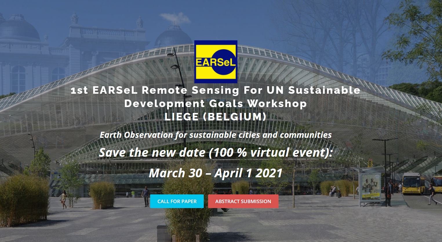
This event is a combination of
- 4th joint EARSeL LULC & NASA LCLUC Workshop
- 6th EARSeL Joint Workshop Urban Remote Sensing
- 1th EARSeL Remote Sensing For UN Sustainable Development Goals Workshop
KEY DATES