- Coarse NWP models poorly represent urban processes
- Missing sub-grid LCLU variability
- Anthropogenic heat (AH) is poorly constrained
What LES Reveals
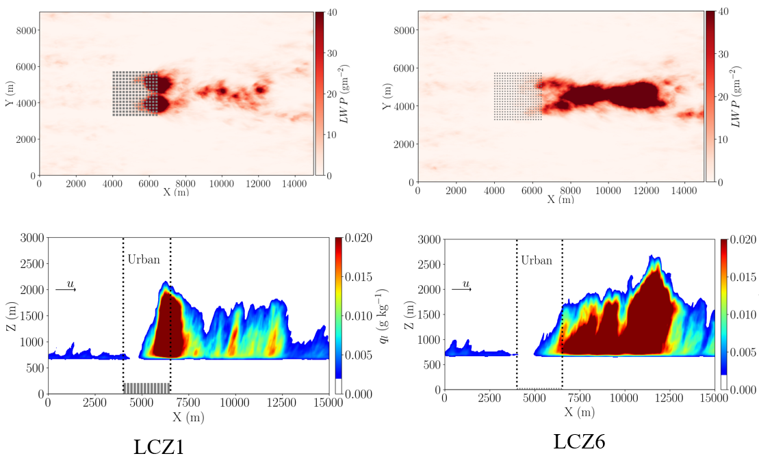
Fig. 1: Urban morphology controls convection and cloud formation
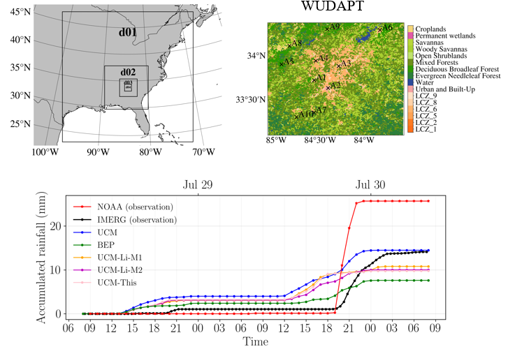
Fig. 2: Accumulated rainfall from IMERG, NOAA observations, and model simulations

Why is this Important?
Urban land use and land cover strongly control surface heat, moisture, and momentum fluxes, so poor representation of these processes directly limits prediction of urban heat island and extreme precipitation. High-resolution remote sensing is important because it provides spatially detailed, physically relevant information, especially for anthropogenic heat and urban surface properties,that can be translated into effective parameters for WRF.
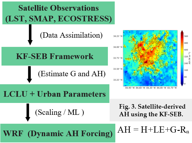
How satellite data are being used?
References
[1] Li, Q., Bou‐Zeid, E., Grimmond, S., Zilitinkevich, S., & Katul, G. (2020). Revisiting the relation between momentum and scalar roughness lengths of urban surfaces. Quarterly Journal of the Royal Meteorological Society, 146(732), 3144-3164.
[2] Cui, Y., Chu, M., He, Z., Albertson, J., Wang, Z., & Li, Q. (2025). Estimating anthropogenic heat flux by assimilating meteorological observations with a Kalman filter approach. Philosophical Transactions of the Royal Society A: Mathematical, Physical and Engineering Sciences, 383(2308)
Project Investigator: John D. Albertson, Cornell University, NY, USA; Email: albertson@cornell.edu
The opinions expressed are solely the PI's and do not reflect NASA's or the US Government's views.