- Satellite land surface temperature (LST) is often used as an indicator of urban heat hazards.
- ECOSTRESS provides high-resolution LST data spanning the entire diurnal cycle.
- However, satellites do not measure the air temperatures that directly influence humans.
- We used ECOSTRESS data and land cover indices to predict dry and wet-bulb temperatures at indoor and outdoor neighborhoods in Ahmedabad and Surat.
How do LST and land cover influence air temperature?
We explored the relationships between ECOSTRESS land cover data and microclimate data from ground-based sensors in Ahmedabad and Surat. Associations between LST and air temperature were stronger at night than during the day, during the dry season compared to the monsoon season, outside versus inside houses, and for dry-bulb than wet-bulb temperature. We developed machine learning models to predict air temperature based on LST and land cover variables characterizing vegetation, water, impervious surfaces, 3-D building structure, and albedo. Incorporating these land cover variables improved the accuracy of models compared to models based only on LST, particularly during the day, at indoor locations, and for wet-bulb temperature. These associations reflect the influences of land cover on thermal and radiative properties, evaporative cooling, and air movement.
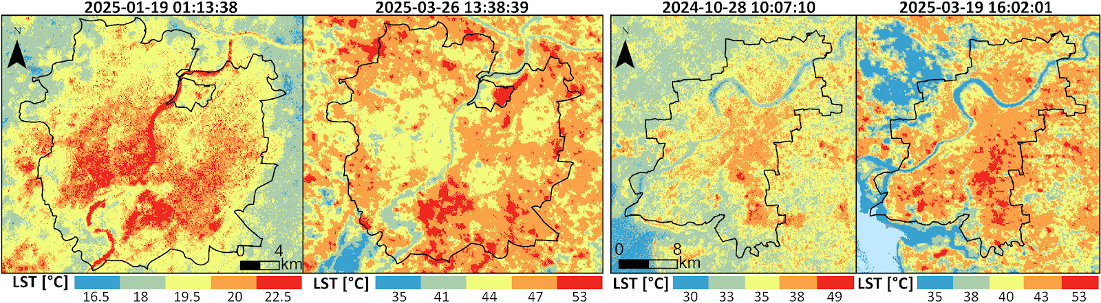
Figure 1: ECOSTRESS land surface temperature images from (left to right ): Ahmedabad night, Ahmedabad day, Surat night, Surat day.
Why is this Important?
LST data must be integrated with land cover data to generate accurate predictions of dry and wet-bulb temperatures in cities. Machine learning techniques can elucidate the complex interactions between LST and land cover, providing more accurate predictions than simpler modeling approaches.
How satellite data are being used to inform decision making and Earth Action?
Predicting the locations and timing of heat hazards is important because these exposures vary greatly across cities, and these differences influence human health risks.
Jamal et al., 2023. Spatiotemporal patterns of urban heat in indoor and outdoor microclimates. Environmental Research Letters, 20, 114050.
Project Investigator: Michael Wimberly, University of Oklahoma, mcwimberly@ou.edu
The opinions expressed are solely the PI's and do not reflect NASA's or the US Government's views.